A Brief History of Chingford
Chingford seems to have been settled in late Saxon times, although it was not until the Domesday survey of 1086 that we have real evidence of its existence. There were perhaps some 200 people mostly serving the two Manors, St Pauls and Robert Gurnons and they subsisted by a simple form of agriculture. The community continued under the manorial system until its final demise in the nineteenth century, being little more than a small village until after the railway came in 1873. This brought many visitors from the East End of London in order to enjoy the delights of Epping Forest on our northern borders, followed by those moving to the town where commuting to the city became easy. From that time on the pace of change in Chingford accelerated; the lands and the farms of the old manors were sold off for housing and shops leaving only a few green spaces, Larkswood and Ridgeway Park being about the largest. Fortunately, Epping Forest has proved an effective barrier to further expansion towards the north. Today there is little of Old Chingford to be seen but some examples are given below:
Chingford Old Church (All Saints)
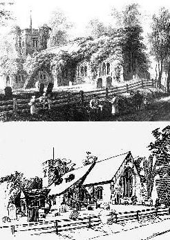
The earliest reference to a church on the hill is in a document dated 1181 but at some time before the 13th century the former Norman church was demolished. On the site, a church was built in the Early English style consisting of a chancel, nave and south aisle. Some 150 years later a tower of Kentish sandstone was added. It was a simple four square structure with no doorway, buttresses or stair-turret and indifferent windows. A Tudor brick porch was added in the 16th century. Services continued to be held until the building covered in a growth of ivy became unsafe. Services were discontinued and in 1844 a new church on The Green supplanted it in popular favour. The church deteriorated further in the years to come and in 1904 the roofs of the nave and south aisle collapsed. The top picture shows the depressing state of the church as it was in the first part of the 20th century. At last in 1929 due to the generosity of Miss Boothby Heathcote the church was completely restored as can be seen in the bottom picture.
Queen Elizabeth's Hunting Lodge
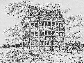
The Lodge was in fact built in 1543 in the reign of Henry VIII although it will always be associated with Elizabeth I. It was built as a grandstand or "standing" on which the royal party could assemble to watch sport. As can be seen by the picture the spaces between the studs on the upper floors were left open at breast height for the convenience of viewers. Elizabeth certainly used it as did James I but gradually it ceased to be used for its original purpose and in the eighteenth century the upper viewing spaces were filled in.
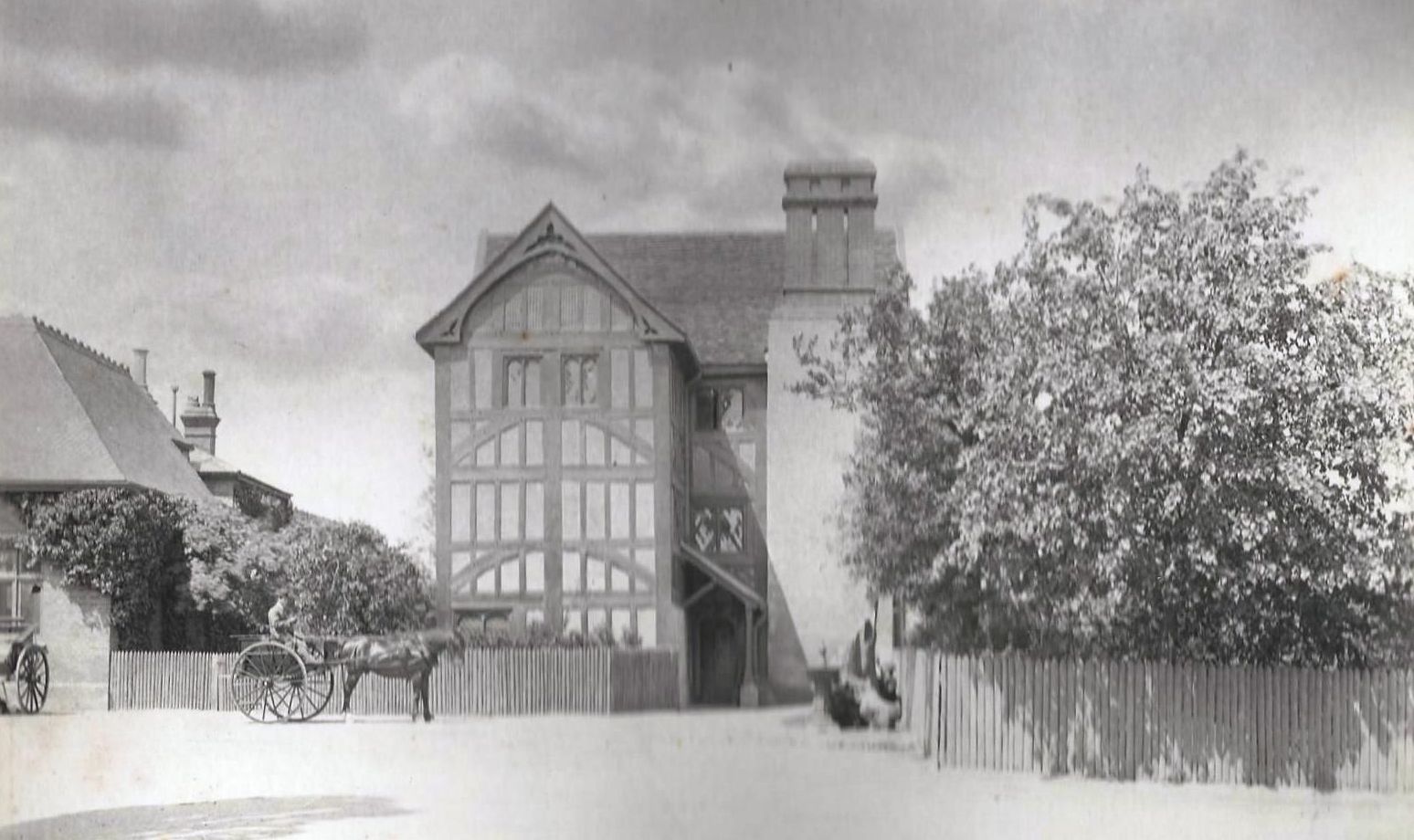
It was used as a keepers or "bailiffs" lodge in later times and even as a Forest "retreat" for serving teas in the Victorian era. Acquired by the Corporation of London and with the co-operation of the Essex Field Club it was converted into a Museum. The picture on the right shows it as it is now, having been extensively restored in the late 20th century. It is open to the public.
Friday Hill House
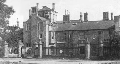
A local manor house built for Robert Boothby Heathcote in 1839 to replace an earlier one on the same site. The house was of white brick in a mixed Elizabethan style. The well known Victorian architect was Lewis Vulliamy. The last of the family to live there was Louisa Boothby Heathcote. The estate was sold for housing and the house itself became a Community Centre.
Pole Hill
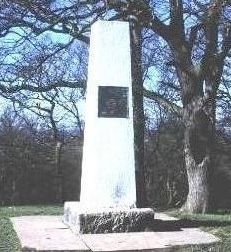
The pillar shown here is on Pole Hill in Epping Forest just in the boundary of Chingford. Its purpose is explained on the plate affixed to its side and reads as follows:
THIS PILLAR WAS ERECTED IN 1824 UNDER THE DIRECTION OF THE REVEREND JOHN POND M A, ASTRONOMER ROYAL. IT WAS PLACED ON THE GREENWICH MERIDIAN AND ITS PURPOSE WAS TO INDICATE THE DIRECTION OF TRUE NORTH FROM THE TRANSIT TELESCOPE OF THE ROYAL OBSERVATORY. THE GREENWICH MERIDIAN AS CHANGED IN 1850 AND ADOPTED BY INTERNATIONAL AGREEMENT IN 1884 AS THE LINE OF ZERO LONGITUDE, PASSES 19 FEET TO THE EAST OF THIS PILLAR